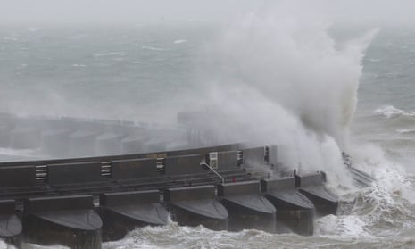
The Met Office has declared Storm Doris a “weather bomb” as gales and snow hit parts of Britain.
High winds brought widespread travel disruption on roads, rail, in the air and on the water. A woman died in Wolverhampton city centre after suffering serious head injuries after being hit by falling debris.
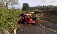
In Cornwall, a man was taken to hospital after being rescued by firefighters when a tree hit his van on the A374 near Torpoint. The extent of his injuries was not known.
The QE2 bridge in Dartford, Kent, the Orwell bridge in Suffolk and the Severn bridge between England and Wales were closed because of the high winds. The port of Liverpool was closed due to gusts of 100mph. In Scotland, the M80 was closed between Glasgow and Stirling because of heavy snow but later reopened.
In north Wales, a 94mph gust hit Capel Curig, although later wind speeds of 80mph were recorded, suggesting the storm had passed its peak. Winds of 60mph-plus were reported elsewhere.
A weather bomb is an intense low-pressure system with a central pressure that falls by 24 millibars in a 24-hour period.
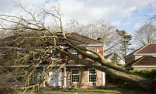
The Met Office extended its amber – be prepared – warning covering Wales and much of England to London, where winds were expected to reach 60-70mph. It said damage to structures, interruptions to power supplies and widespread disruption to travel networks were likely, and there was a danger of injury from flying debris. Trees were likely to be damaged or blown over, it said.
#StormDoris continues to bring very strong winds, heavy rain and snow in places. Here are the highest wind gusts so far pic.twitter.com/TGwvERv95y
— Met Office (@metoffice) February 23, 2017
Aer Lingus cancelled 12 flights within England and between England and the Republic of Ireland, while Heathrow advised passengers to check for delays and cancellations before travelling.
Network Rail imposed speed restrictions on some lines, and services were disrupted by debris and fallen trees. Damage to overhead power lines in St Albans caused trains from St Pancras station in London to be cancelled. Network Rail warned of disruption till midday.
More than 200 homes in Macclesfield, Cheshire, lost electricity because of a fallen tree and there were also reports of power outages on the island of Anglesey, north Wales.
An amber warning of snow remains in place for north-east England and southern and central Scotland. The Met Office said up to 30cm was possible on higher ground.
Yellow – be aware – warnings were in place for Northern Ireland and the rest of Scotland, for wind and snow respectively.
In the Republic of Ireland, where Met Éireann issued a yellow warning predicting winds of up to 75mph, almost 50,000 homes were without power on Thursday morning, mainly due to fallen trees knocking down power lines.
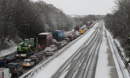
Highways England issued a weather alert on major roads. It said high-sided vehicles, caravans and motorbikes were particularly at risk, and it “strongly advised” drivers to avoid travelling on some stretches of road in Yorkshire, the Midlands, and the east and north-west.
Richard Leonard, the head of road safety at Highways England, said: “We’re expecting Storm Doris to have a significant impact on the roads throughout the day so are urging drivers to consider changing their plans if necessary and to slow down in stormy weather. Drivers should look out for warnings on the electronic message signs and listen for updates in radio travel bulletins.”
AA spokesman John Snowling said: “The unpleasant combination of torrential rain, severe gales and heavy snow will create some very poor driving conditions, with the potential for roads to be affected by black ice, debris or standing water.
“Wind can also bring down tree branches, blow you off course or blow other vehicles into your path. Expect travel disruption as some roads will be treacherous.”
Storm Doris is expected to move on quickly, with the worst of the weather gone by Thursday evening. More wind and rain is forecast for the weekend and into next week, but it is not expected to reach the extremes of Doris.
The bad weather contrasts with earlier in the week when visitors to Kew Gardens in west London enjoyed the UK’s warmest day of the winter so far, at 18.3C (64.9F). Parts of London and the south of England had temperatures warmer than southern Spain.
