


Editor’s Note: Voice Memo is a series of phone conversations between CNN Style journalists and image-makers around the world. Click here for more.
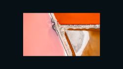
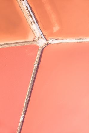
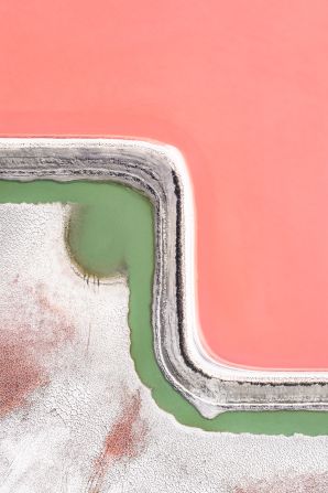
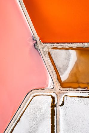
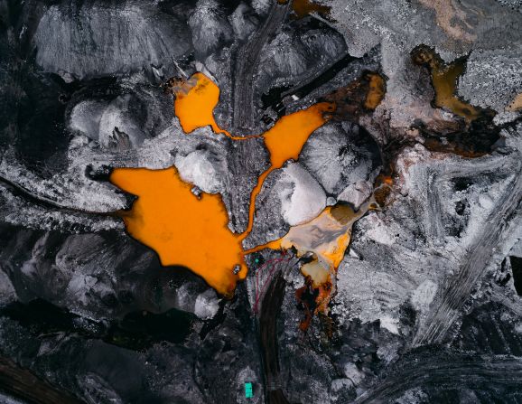
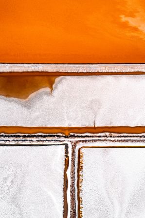
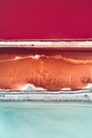
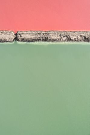
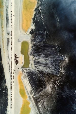
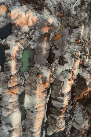
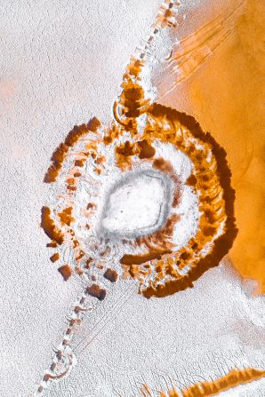
Viewed from above, the Mediterranean’s salt farms take the form of abstract paintings. Piles of crystallized salt, which divide the artificial ponds, appear like lines of white paint between blocks of saturated green, red, orange and pink – colors created by algae and other microorganisms in the shallow seawater.
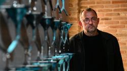
Shot in Spain and southern France, these images were taken by aerial photographer Tom Hegen, who uses drones, hot air balloons, helicopters and planes to document the impact of human activity on the natural world.
Tom Hegen's aerial photography
“I use abstraction and aestheticization to get the viewer’s attention,” the German photographer said in a phone interview. “When first looking at the photos I (want people to) think, ‘wow this is really stunning and beautiful.’ But I hope that, on second glance, they wonder what they’re looking at, and why it looks the way it does.”
‘Transformed’ landscapes
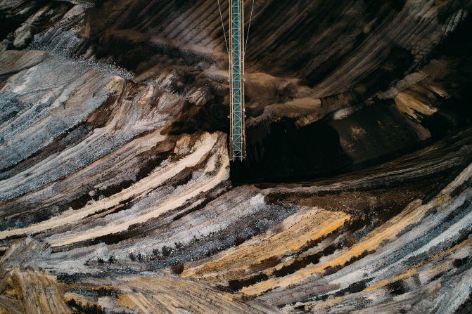
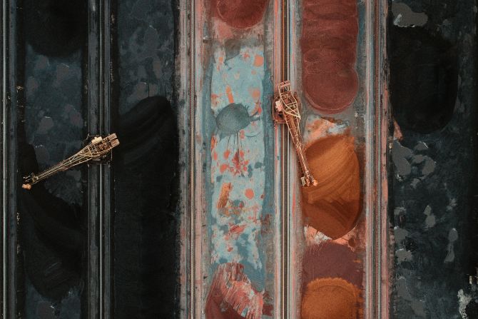
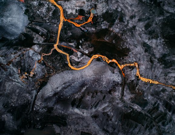
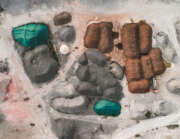
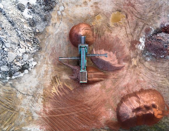
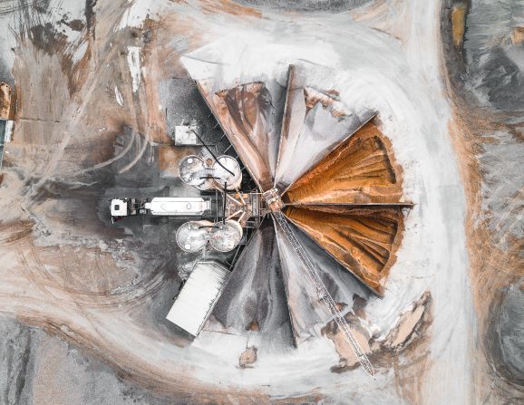
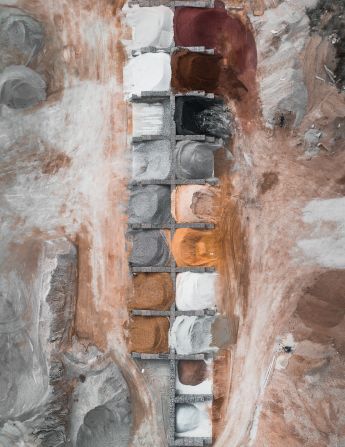
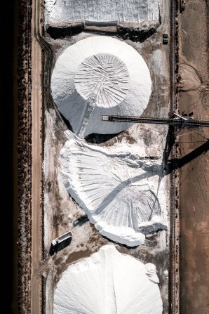
Titled “The Salt Series,” the collection is Hegen’s latest attempt to capture “landscapes that have been heavily transformed by human intervention.” Other recent projects have seen the 27-year-old photographing quarries, farmland, coal mines and waterways discolored by the byproducts of industry – all from above.

What began as a master’s degree thesis called “Habitat” is now set to become a book of the same name. Inspired by a Munich exhibition exploring the “Anthropocene” – a proposed term for a new geological age created by humans – Hegen said that he wants people to rethink how everyday materials are produced.
“Scientists now say that we live in a new human era,” he said, “because we’ve had such a huge impact on our planet by changing its geological, biological and atmospheric processes.
“I don’t want to be the guy pointing the finger and saying ‘look what we’ve done wrong.’ I more want to inspire people. For example, the photos in (my collection) ‘The Quarry Series’ are just next to the road where we live, but no one really cares about where their materials come from. Or with ‘The Salt Series’ – no one really asks where their salt comes from.
“I want to put focus on these topics, and then maybe people will treat it as a starting point for thinking more about how we do things.”
A sense of scale
Specializing in aerial photography while still at university, Hegen began using drones three years ago after he assembled his own custom quadcopter and equipped it with a camera. While flying the devices, he watches through a monitor at ground level, adjusting the drone to create his geometric compositions.
Hunting for locations using Google Earth, and ensuring that weather conditions are suitable for flying, Hegen depicts aerial photography as an art grounded in painstaking preparation.
“I don’t really focus just on the technical (side) of what’s being produced,” he said. “I spend more time doing research than getting the photos or the technique. Drones are so much fun to fly and I appreciate them a lot, but for me it’s just about the outcome.”

His pictures are often taken just after sunrise, or just before sunset, the so-called “golden hours” of photography. By pointing the camera directly down at the Earth, the images appear completely flat, giving them a surreal aesthetic quality.
More importantly, Hegen said, the aerial shots reveal the enormity of the facilities, farms and landscapes being profiled.
“For sure, we can see all of these things from the ground as well,” he said. “But if you show it from a different perspective, you can really show the scale.”